Know Thy Traffic - IIT Madras creates Real Time Traffic Information System for parts of OMR & South Chennai
With increasing traffic bottleneck in OMR and other parts of South Chennai , IIT Madras has come up with an initiative called Real Time Information System for tackling the congestion.This is a prototype project created by the team .
What is this Real Time Traffic Information System?
It provides information on the following about the current traffic:
Alternate Routes and Travel times
Which route should you take? The shortest one or the fastest one? These maps help on it. For example , from Tidel park on OMR to Vijaynagar in Velachery , for travelling on two wheeler , the website provides the following(for the current time):
 |
| Courtesy:http://rtis.iitm.ac.in/rtr.php |
Congestion and Speed Maps:
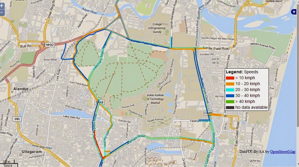
How congested is OMR? What is the average speed on the road? Congestion maps help on figuring it out. Here is a sample congestion map provided by the website
 |
| Courtesy:http://rtis.iitm.ac.in/speedmap.html |
Delay Maps
How long should you wait in the traffic? Delay maps provide info on it:
 |
| Courtesy: http://rtis.iitm.ac.in/losmap.html |
Variable Message Signs
Electronic sign boards are kept at key junctions to provide traffic information.
For example :
 |
| Courtesy: http://rtis.iitm.ac.in/vms.html |
Live traffic camera
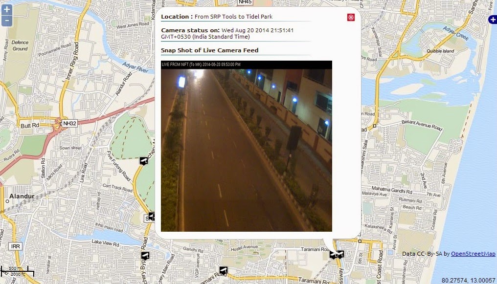
Live images shot from traffic camera are updated on the website. It is around 9.50 pm as of writing this post and there is no vehicle spotted on OMR from SRP tools to tidel park! |
| Courtesy: http://rtis.iitm.ac.in/camera.html |
How is this different from traffic information given in Google Maps?
Google maps uses the average moving speed of Android phones on a particular road to calculate traffic information whereas this system uses devices fit in about 100 MTC buses.
Which areas does this system cover as of now?
As mentioned in the website,
"This study corridor is 16 km long and includes parts of OMR, Velachery Taramani Road, Velachery Main Road, Velachery Bypass Road, Sardar Patel Road, Taluk Office Road"
The system uses advanced technologies like GPS, video cameras, wireless communication, traffic models and algorithms to provide live traffic information.
Will this help ease the congestion on OMR?
Upto the OMR Riders!
Provide your feedback here:
http://rtis.iitm.ac.in/feedbackpage.html
References:
http://rtis.iitm.ac.in/index.html
http://timesofindia.indiatimes.com/City/Chennai/With-cellphone-data-tech-will-give-motorists-estimate-of-travel-time/articleshow/40437048.cms
Provide your feedback here:
http://rtis.iitm.ac.in/feedbackpage.html
References:
http://rtis.iitm.ac.in/index.html
http://timesofindia.indiatimes.com/City/Chennai/With-cellphone-data-tech-will-give-motorists-estimate-of-travel-time/articleshow/40437048.cms
Comments
Post a Comment